Month: October 2025 (Page 4 of 6)

The Travels of Marco Polo Map (Andrew Conte)

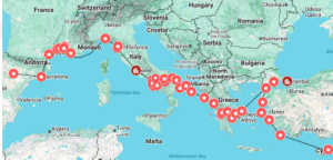
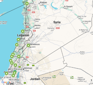
Google Earth Link: https://earth.google.com/earth/d/1v7kiuzXSZ4p4Aypj01Zrl8P6ZBQ6v2wK?usp=sharing

***I am using a different translation of the text, if some city names are not familiar, it is because my version of the text is weird. Thank you for understanding!***


Red: Major Cities Kanbalu (Beijing) and Kin-sai (Hangzhou)

The red markers indicate major cities. These are distinctive cities that Polo pays extra attention to. Some notable qualities of both is that a person of great power and high imperial distinction lives there (such as the Khan), the city is large and has a great population, there is a bountiful trade market in the city, there is notable architecture, the livestock and goods are very valuable, and finally that the economy of the city and specifically the treasure belonging to the Khan. These cities serve as capitals to either the region or greater territory.


Yellow: Chan-glu (Cangzhou), Tin-gui (Changzhou), Yan-gui (Yangzhou), Non-king (Nanjing),  Sin-gui (Suzhou), Kin-sai (Hangzhou)

The yellow markers signify cities or regions that Marco Polo pays special attention to because of their economic value and output into the trade market. For instance, Chan-glu is one of his first stops going down the eastern coast of China. Polo notes the great amount of salt they produce and how they are able to harvest it from the salt-water in that area. Another notable city Polo talks about is Yan-gui which is notable for the arms and other military goods it produces for the greater area. Polo notes that because this city is so good at producing means for war, many soldiers are stationed in that part of Cathay (China).


Blue: Kara-moran (Yellow River), Singui-matu (Jining),  and The Great River Kiang (Yangtze River)

The blue markers are waypoints for any location Marco Polo travelled to that has considerable geography, specifically for boat travel and trade. The two biggest examples are Kara-moran and The Great River Kiang. Both are notable to Polo becasue of their great size which allows for many boats to sail to different parts of Cathay.  Specifically with the Kara-moran, Polo notes boats carrying their loads of goods to a port only a mile from the sea that can hold up to 15,000 boats. Additionally, the source for the water in the Kara-moran is supposed to be under the control of Prestor John, the mythical Christian king of the East.

The Modern Map of Margery Kempe

Link: https://earth.google.com/earth/d/1qwvsQi23FlRXqzBEZaYavepfgs8t_jvk?usp=sharing

I separated Kempe’s locations of travel based on the levels of religious experience/importance, and thus Kempe’s personal experiences in these locations.


Green – Little Religious/Personal Importance

Norwich, Great Yarmouth, and Bologna are in the Green Category. Each category is separated based on the level of importance to Margery Kempe. The analysis of her descriptions of each location revealed that the length, intensity of emotion, and religious acts contribute to how important/memorable these locations are to Kempe. Because Norwich, Great Yarmouth, and Bologna are very briefly mentioned, it can be assumed that Kempe did not have intense visions or experiences in these cities.


Yellow – Medium Religious/Personal Importance

Zierikzee, Konstanz, and Venice are divided into the Orange Category. This category is separated by a medium level of significance to Kempe, where she detailed more events and religious experiences than those locations in the Green Category, but still are not specifically altering to her being (relative to the locations in the Red Category). The reader has more of an idea of her experiences, companions, and treatment in these places, and there are more significant religious aspects, but they are not as significant as the locations in the Red Category.


Red – High Religious/Personal Importance

Jerusalem, Bethlehem, the Jordan River, and the Mount of Temptation belong in the Red Category because they are the most significant in the Bible, and therefore to Kempe. She gives the most description of these places and the surrounding areas, the religious events that occurred there (and why they are so important to her), and the people she meets along the way in these places. The strangers she meets in these places also seem to become kinder to her, perhaps due to their proximity to the Holy Land.

Ibn Fadlan’s Journey on a Modern Map

Map Link:

Category key:

The different icons correspond to the category I selected for each location, which describes Ibn Fadlan’s experience with that location. 

The star icon – Mark Ibn Fadlan’s home and destination for this journey. 

The bed icon – Places where Ibn Fadlan and his group only visited because they needed to break up the trip, and did not do much more than sleep. 

The lightning bolt icon – The places where Ibn Fadlan faced difficulties.

The walking icon – Locations where Ibn Fadlan and his group passed through to get to the next location. 

Ibn Fadlan: From Merv to Atrak’s Camp

Mapping Link: https://www.google.com/maps/d/u/0/edit?mid=1KkXuoGbWTl7zwncmnP96q1LLvaqz4sc&usp=sharing

Key For Categories

Description of Icon Color Category
House Red Home of Traveler
Bed Teal Lodging
Shopping Cart Green Trading Post
Car Yellow Brief Stop (not much is described at this location)
Building with Columns Purple Political
Two Houses Dark Blue Shelter and Long-term Stay
Two People Walking Blue Culture

Ibn Fadlan: Where did he go?

Link to map 

Map color Key:

Red=Major locations that have been detailed in depth/own sections:

Baghdad: Where he begins,

Bakhara: Where he stops and gives a first look into another culture

Khwarazm(Kath): Where he gives his second account of Culture

Bulghar: His end location, where he spends a great amount of time discussing their culture and conversion.

Blue=Locations that are mentioned with some detail (about their journey, not these places’ cultures):

Rayy: We learn that they waited for Ahmad ibn (they were in the wrong location)

Jit: They got stuck due to the snow and had to stay for two days so their camels could walk through the snow

Yellow=Locations that are mentioned in passing with no additional information:

Nishapur: The only information is that they made it here with the concealed caravan, but no additional trip info is given (no time, no weather, etc.)

Sarakhs: Absolutely no information is given

Nahrawan: We only know they stayed one day

Simnan: Once again, no information is given

Felix Fabri: Modern Map

Here’s the link to my map on the Wanderings of Felix Fabri:

https://www.google.com/maps/d/edit?mid=18yLeabCtHe9qZXRYQ6KRjVoUrFovoIY&usp=sharing

Categories: I separated Felix Fabri’s Wanderings into categories based on terrain and physical description. Fabri focuses a lot on his natural surroundings for the beginning half of the pilgrimage. However, once he leaves Venice and travels toward the Holy Land, his physical descriptions diminish. This shift illuminates an interesting mindset regarding the authenticity of the Holy Land and his aim to preserve Jerusalem in its most honest state.

Key:

🏔️: mountainous region 

☀️: valley region 

🌊: Water/Ocean Region 

✝️: Holy Land – Jerusalem 


Margery Kempe Modern Map Assignment Norfolk-Jerusalem-Rome

Here is the link to my map:

https://www.google.com/maps/d/u/0/edit?mid=1H-JXjjcZgqbywpIZ1ZGmH0vX1edEvaI&usp=sharing

Blue Line: Her travels from Norfolk-Norwich-Yarmouth-Zierikzee-Konstanz-Bologna-Venice-Jerusalem

Red Line: Her travels from Bethany-Jerusalem-Back to Venice-Assisi-Rome

Blue icons: Places she went to in Europe

Red Icons: Places she went to in Asia

Each icon is given with a symbol which shows her mode of transportation at each region

a descripition is given in each text box of each location


Benjamin of Tudela Modern Map

Europe

Asia

Link to full map: https://www.google.com/maps/d/edit?mid=1KbMXk61iebYfY4LHM5QQkYRSbhjzPmw&usp=sharing


The main two categories are by region. I have mapped Benjamin of Tudela’s travels in Europe (red) and Asia (green). Important locations on which he spends the most time are marked in slightly darker colors with city icons.

« Older posts Newer posts »

© 2026 Mapping the Global Middle Ages


Academic Technology services: GIS | Media Center | Language Exchange

Theme by Anders NorenUp ↑