Maps of individual arrests by U.S. officers under the Fugitive Slave Law,1850-1854. Created using Palladio (Stanford University) and Historical Map Chart (https://historicalmapchart.net/usa-historical.html), from the data set assembled as part of this thesis project. The maps include only arrests made by federal officers, not instances of recaption initiated by slaveholders. Data is configured by the number of individuals arrested (total of 81), not by instances of arrest.
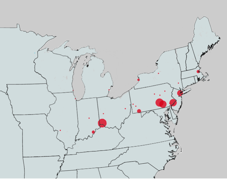
Concentration of arrests by U.S. officers under the Fugitive Slave Law, 1850-1854
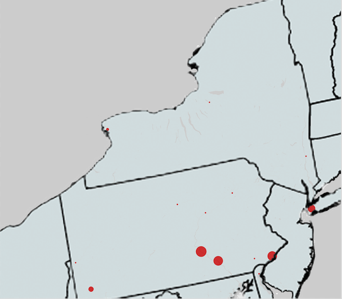
Arrests by U.S. officers in the Lower North, 1850-1854
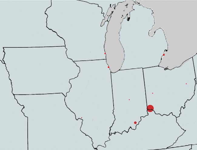
Arrests by U.S. officers in the West, 1850-1854
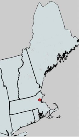
Arrests by U.S. officers in New England, 1850-1854
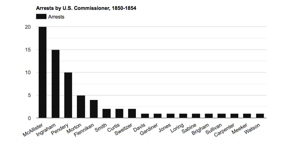
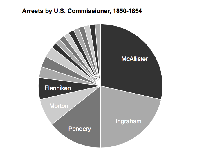
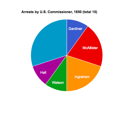
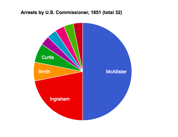
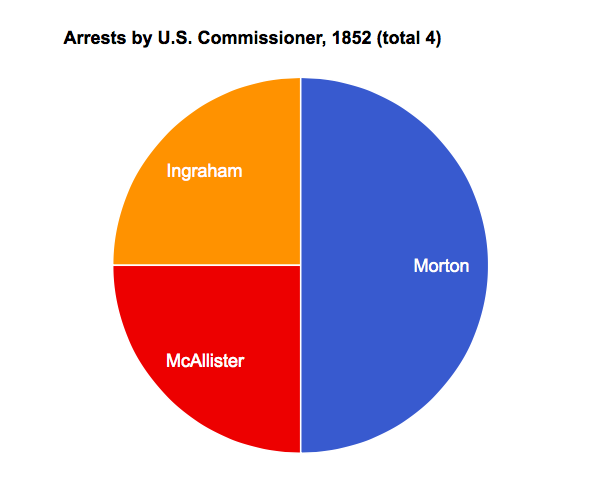
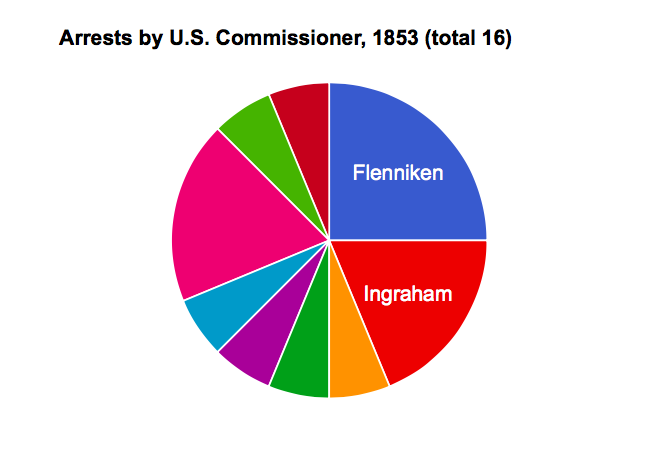
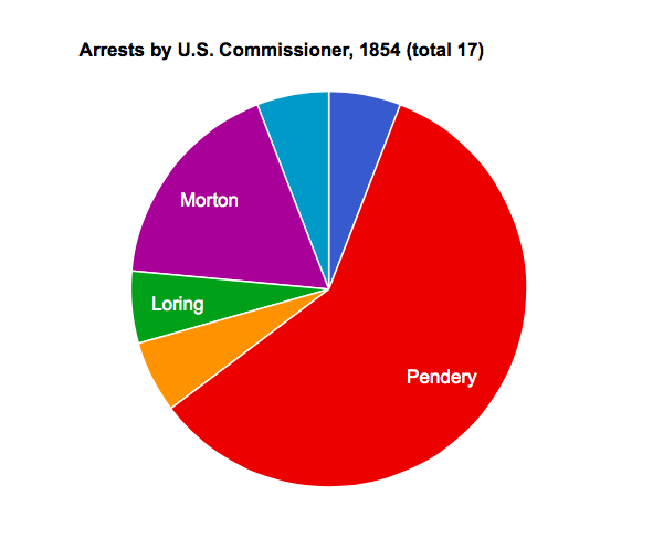
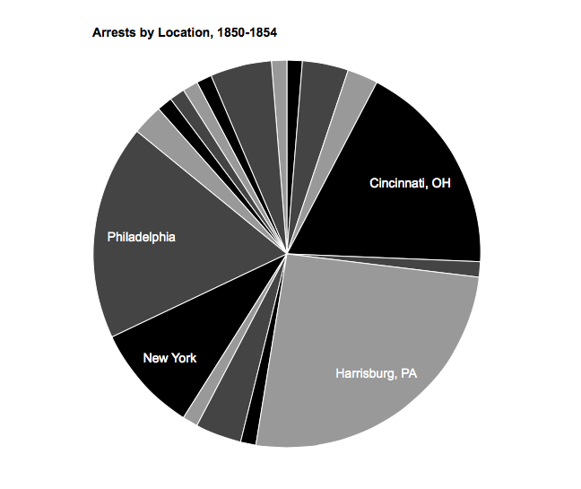
Charts created using SHIVA (University of Virginia), using the data set assembled as part of this thesis project.