By Will Nelligan
Upon his arrival at Vancouver International Airport in the fall of 1964, President Lyndon Johnson remarked, “no nation in the world has had greater fortune than mine in sharing a continent with the people and the nation of Canada.” In an address to the Canadian parliament more than a decade earlier, President Dwight Eisenhower described a Canadian-American border that “grows stronger every year, defended only by friendship.” Eloquent as such sentiment may be, that friendship-fortified dividing line was not always uncomplicated. In fact, after the Revolutionary War, Americans grew accustomed to many complications with their northern neighbors, particularly regarding issues of boundaries and borders. It was the Webster-Ashburton Treaty, authored in 1842 by Secretary of State Daniel Webster, that cultivated the enduring friendship between Canada and the United States that Johnson and Eisenhower could proudly proclaim more than a century later. The more than half-century between the signing of the Treaty of Paris in 1783 and the signing of the Webster-Ashburton Treaty in 1842 offers a rich and relatively-unknown example of America’s earliest diplomacy.

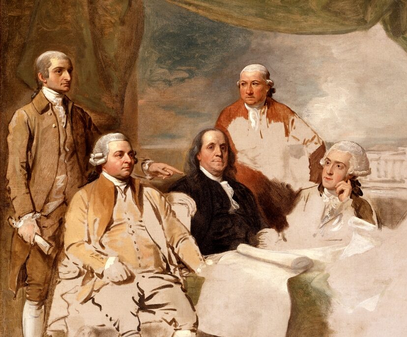
A map used by negotiators drafting the Treaty of Paris. Photo courtesy:: Library of Congress
In an effort to secure “perpetual peace and harmony” between the United States and Great Britain, the Treaty of Paris drew clear and mutually-agreeable boundaries between the United States and Canada, a British colony. The treaty drew Maine’s boundary with Canada largely as it is today, but as a great deal of history has shown us over the ages, borders are rarely as simple as what is drawn on a piece of paper. Less than a year after the treaty was signed, conflict over the enforcement of its border provisions had already begun in broader New England. The likely earliest published account of such conflict was printed just a year after the treaty was signed. A September 1784 issue of Boston Magazine described the refusal of Governor Frederick Haldimand, the Governor of Quebec, to release territories “within the limits of the United States” that were occupied by British soldiers. While letters exchanged between the governors of New York and Vermont and Governor Haldimand suggest a delay in the latter’s official notification of the Treaty of Paris, correspondence between Haldimand and Lord Sidney, the British Trade Secretary, suggest something different. In letters exchanged between Haldimand and Lord Sidney in April and May, Sidney counsels Haldimand against retreating from the occupied North Hero Island, in northern Vermont’s Lake Champlain. “As America has not complied with even one article of the Treaty,” wrote Sidney, “I think we may reconcile it in the present instance to delay the evacuation of those posts.”
The tenous relationship between Vermont and Canada traveled east to Maine where it joined with confusion. As historian Francis Carroll explains it, the original treaty’s boundary descriptions of Maine’s Canadian border relied on subjective geographic terminology. In the interest of defining the borders of a new nation, Benjamin Franklin and his cohorts had rushed to set specific boundaries in the Treaty of Paris. Later treatymakers saw bigger unresolved issues, such as trade rights, access to fisheries, and the allegiances of American Indian populations, and were perfectly amenable to passing off border issues to joint commissions and survey groups. Over the course of the next 40 years, those commissions would form, decisions would be made, a war would be fought, but no outcome seemed to be able to stand the test of time.
Historian Howard Jones, a noted expert on Canadian-American relations, identifies the winter of 1839 as the turning point in the long history of unsettled and unresolved border disputes. In January 1839, in an effort to protect the state’s lumber industry from looting in the contested northern border region near New Brunswick, the Maine legislature appropriated $10,000 in support of the Governor of Maine’s request for riflemen and surveyors. In February, New Brunswick issued a proclamation pledging the use of troops if Americans entered their territory. A patchwork of dueling detainments ensued, as did a media frenzy, and finally, cries for war. The Maine legislature authorized more funding for more troops, and the request for federal support rippled across the front pages of newspapers from Bangor to Boston. Bloodless as it had been so far, what diplomats in Washington and London had hoped was a regional geographic problem was likely hurtling towards outright warfare, and thus towards the international stage. In the hindsight of diplomatic history, this seemed bound to happen; borders, as important as they were to states and provinces, were largely regarded as nuisances by international policymakers. Decades of partial resolutions were reaching a breaking point. After two months of standoff in the so-called Aroostook War, Winfield Scott, the prolific American military leader, arrived in Augusta in March of 1839. Much to the relief of many, he was able to negotiate a stop to the proclamations and threats pending a resolution. In 1842, that resolution came.
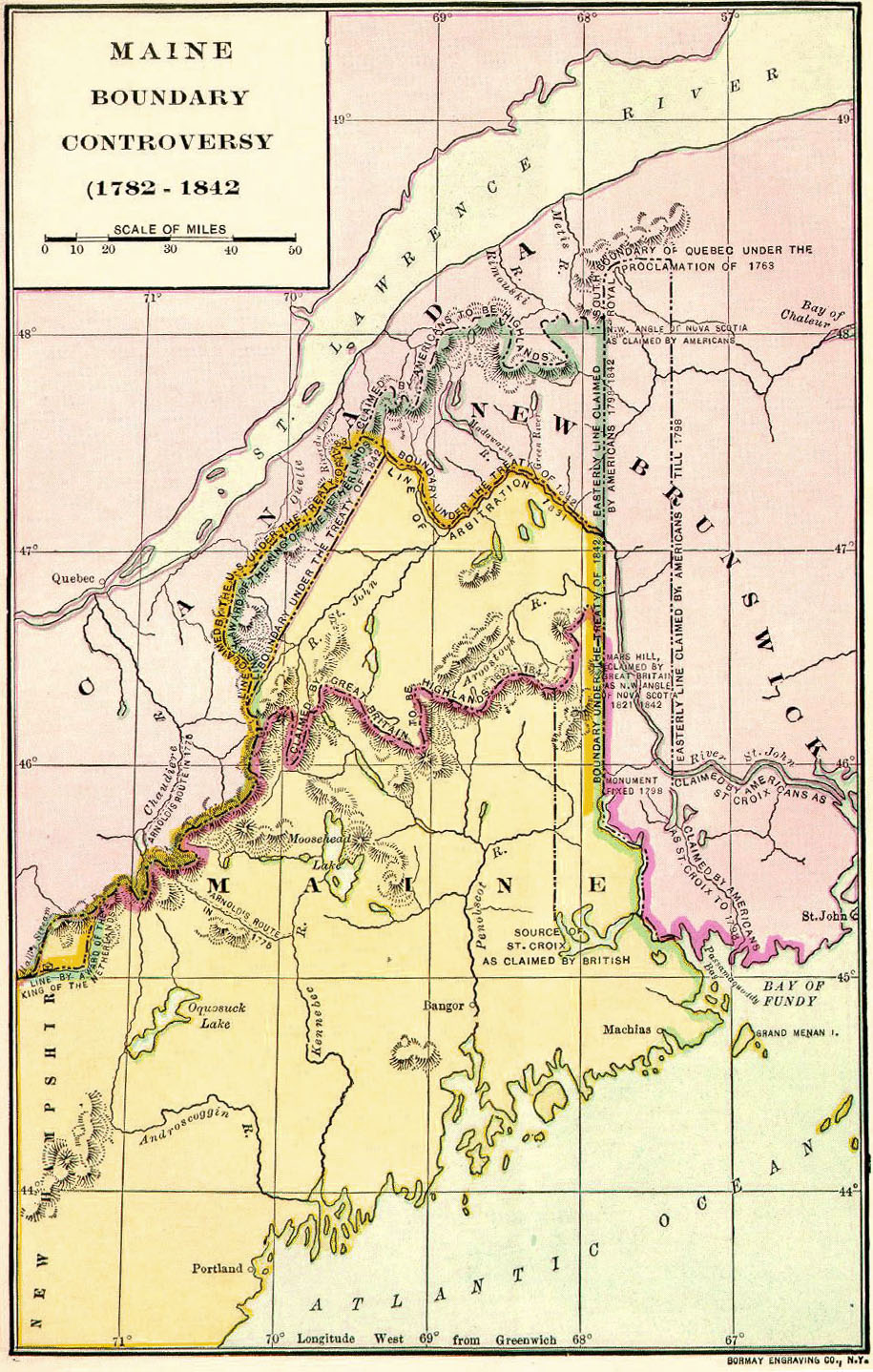
A 20th century map of disputed areas and boundaries drawn by treaties. Photo courtesy: The American Nation Magazine (1906)
The complexity of the boundary disputes in past decades was matched in the negotiations leading to the Webster-Ashburton Treaty. Negotiations took place between Webster and Ashburton, but also included representatives from a variety of states, provinces, and consulates. As Francis Carroll notes though, it may have been the first time that the dispositions of the two sides dovetailed perfectly. Webster and his cohort from Massachusetts and Maine were more willing to accept British and Canadian boundary contentions than previous negotiators, while Ashburton was more motivated to end the conflict. In the years after the Treaty, both would be accused of betraying the interests they had been sent to represent. The merit of those arguments seemed subjective at best, and more likely represented one portion of a larger catharsis needed by the people of the region to move forward with fresh perspective. Questions remained, both about Webster’s tactics and Ashburton’s attitude, but one thing was certain: a lasting boundary had finally been forged.
The statements, events, and outcomes that defined the boundary dispute in Maine offer insight into the priorities foreign policymakers had in the 19th century. In an age when the security of our borders is a perennial issue, the notion of policymakers ceding control of such boundaries to a joint commission in the interest of negotiating on access to fisheries seems foreign. Similarly, the idea that a state and a foreign power could be embroiled in a years-long conflict with little intervention from the national government seems antithetical to the foreign policy process our Constitution mandates. Yet this was the paradigm through which diplomatic history was made in the first half of the 19th century. Later, as changes in technology, industry, and political ideology came about, the paradigm shifted and changed; policymakers developed new priorities and principles that informed their interactions with other nations. However, in understanding America’s first foreign policy framework, that which emerged with the American Revolution, the Webster-Ashburn Treaty and the events preceding it are instructive.
Leave a Reply