Goal
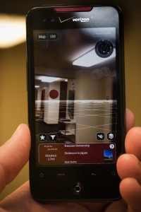
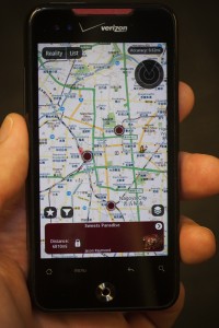
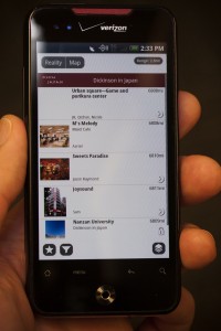
The Instructional Media Services Department worked with the faculty leading the Japan Summer Abroad program to create a student project designed to provide an opportunity for students to become familiar with their new surroundings and culture. The project required groups of students to study and explore a number of locations in their host cities. Students were broken up into small groups and asked to research specific locations in the cities they were staying. The assignment was entirely location based with students creating an augmented reality layer with these points of interest, uploading geo-tagged photos to a Google map and embedding this map into their blog. All these elements integrated along with their travel journals on the course blog.
Program Overview
The Japan Practicum is a four-week summer program that focuses on Japan in the time of the geisha and samurai, the Tokugawa era. During morning classes, students will be learning about history, literature, art and architecture, and then apply the coursework by taking field trips to see the actual sites.
Assignment
Contemporary College Life Presentation using Augmented Reality:
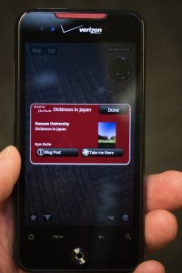
This group project will include getting to know some Nanzan students and finding out about their lives. You will introduce the students and some interesting things you discovered about how their college life is similar to or different from your own. As part of this, you will introduce the class to an important place in their lives outside the college proper, be it karaoke bar, club or park. Add a POI using the layar input form on the blog. Make sure to include a title, short description, picture, latitude, longitude, and a link to a blog post about the student and place. Remember your POI and blog post will help future students find and explore these places.
Blog:
You will be expected to post your thoughts and impressions about your experiences at least twice a week in an online diary. You may miss one entry without affecting your grade. Please include at least one photo with each entry.
Online Discussion:
Three people per day post on things they found interesting in either the sights or the readings. These could be reflective pieces, questions with some thoughts on the answers, or a close reading of a passage. They must be between 200-400 words to receive full credit. Others will respond to these posts with their thoughts.
Photo essay:
You are required to post an selected collection of photos taken during your stay on the practicum picasaweb page. Do not upload indiscriminately, but select the best 20-30 images. After uploading the photos be sure they appear on the map, if not geotag them by hand. These may have a coherent theme or just those you thought best showcased the experience. These must be uploaded by the last day of the program. Cameras are not required, you will be able to borrow a Dickinson GPS camera.
Final Paper and Presentation:
The final project will be the final research paper and presentation. The paper should be a five page paper exploring an idea, location, historical figure or story you found most interesting in your time in Japan. You should give basic background information, but be sure to take us beyond the simple wikipedia entry. The presentation should share what you have learned with the rest of the class through powerpoint. All parts of this assignment will be part of the grade: draft, paper and presentation.
Augmented Reality Layer
 Live View |
 Map View |
 List View |
 Detailed POI |