Trip up: 30 July-1 August 2017
Our trip to Hoodoo Mtn volcano in 2017 was a long, complex but beautiful and interesting journey! Two members of the expedition (Will K and myself) flew in to Vancouver BC to load up on field gear for the trip. We were worried about the drive up, because BC is having a horrendous fire year and those blazes have closed several of the roads that cross center BC. The trip started perfectly though, with a gorgeous view of Mt. Baker volcano, in northern Washington State, which is clearly visible driving out of the Vancouver area on Hwy 1.
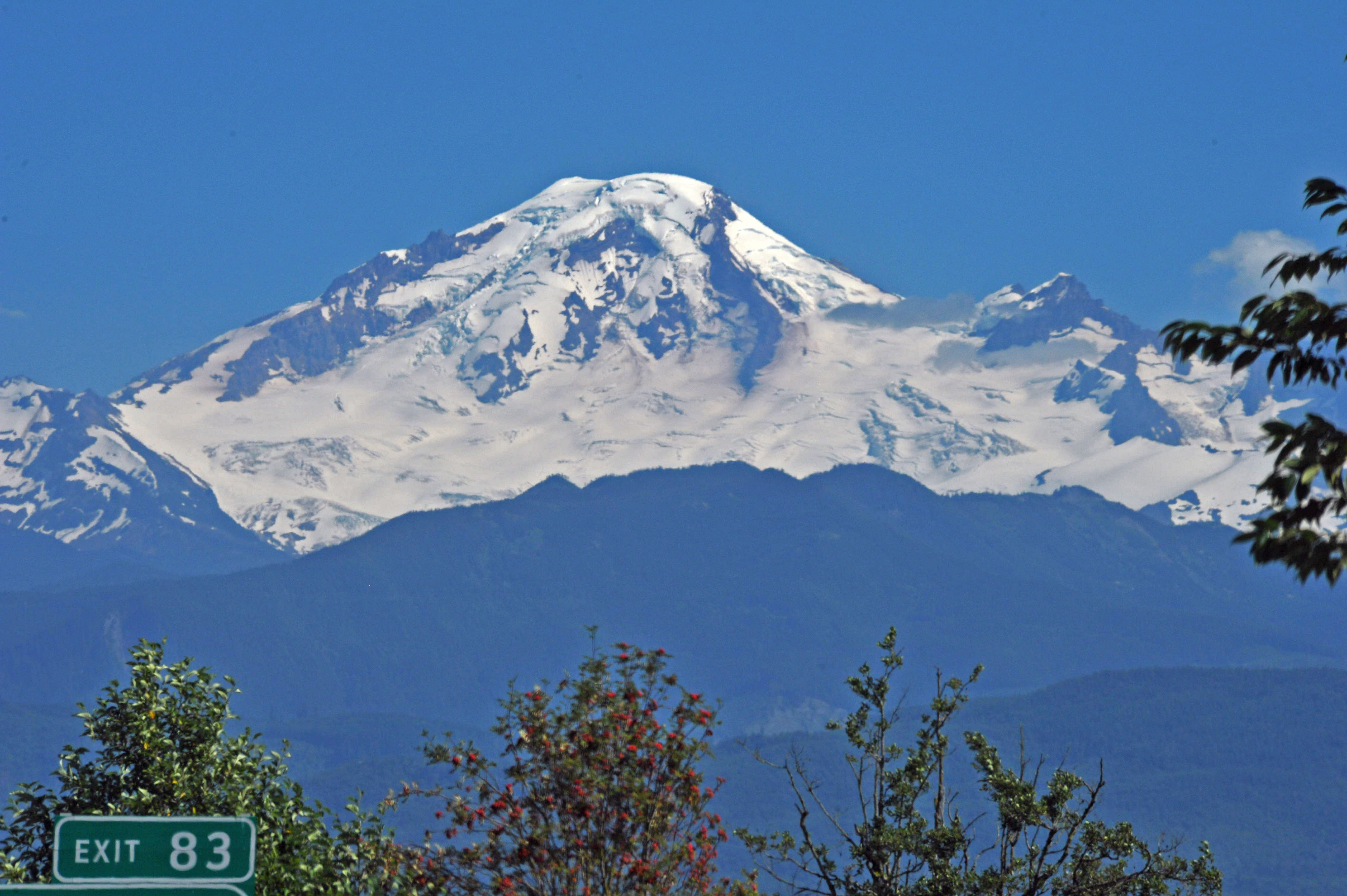
View of the western side of Mt Baker from Hwy #1 outside of Vancouver, heading towards Hope 2017
After checking DriveBC, we thought we could take Hwy 97 north from Hope BC to Prince George, but just outside of Cache Creek we were stopped by a police car across the road and instructed that the Clinton fire had flared, and we would have to detour.
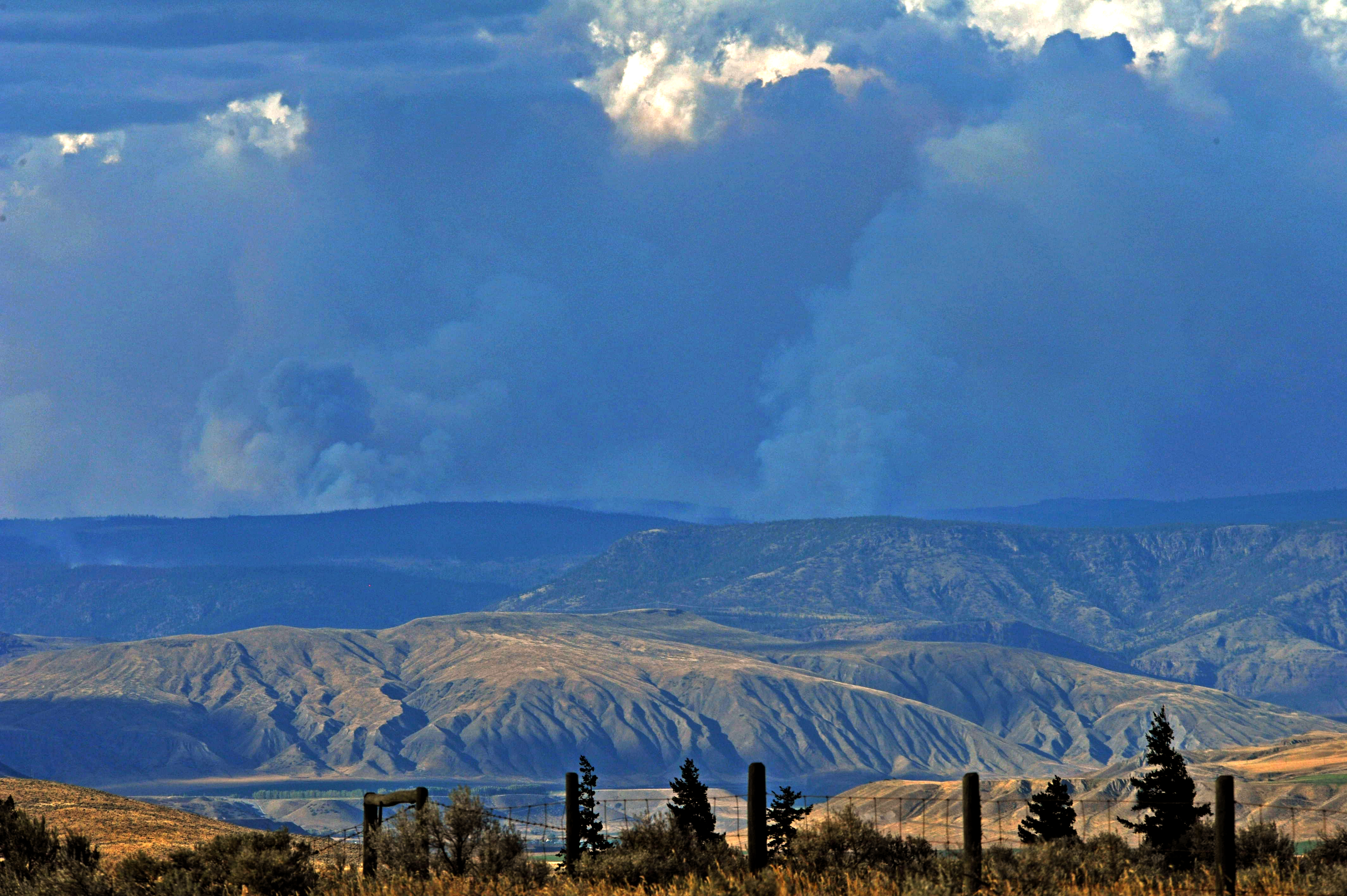
Smoke (lighter grey) rising from two different forest fires in central British Columbia in late July 2017.
We didn’t get close enough to see flames, but we saw plenty of smoke on the detour around to Kamloops and through Clearwater on Hwy 5, which is a scenic route along the western edge of the Canadian Rockies that also ends up in Prince George. It includes a view of Terry Fox Mountain, named for the heroic Terry Fox, who, after losing one leg to cancer. attempted to run on his prosthetic leg across Canada. While he didn’t complete the trip, cancer returned partway through the run, he completed over 3339 miles in 143 days (essentially running a marathon every single day) and he story is incredible http://www.terryfox.org/terrys-story/marathon-of-hope/(http://www.terryfox.org/terrys-story/marathon-of-hope/). I’ve run in 3 Terry Fox runs so far, and am lining up more for Sept 2017 with fellow Canadianologist Kevin Bixby.
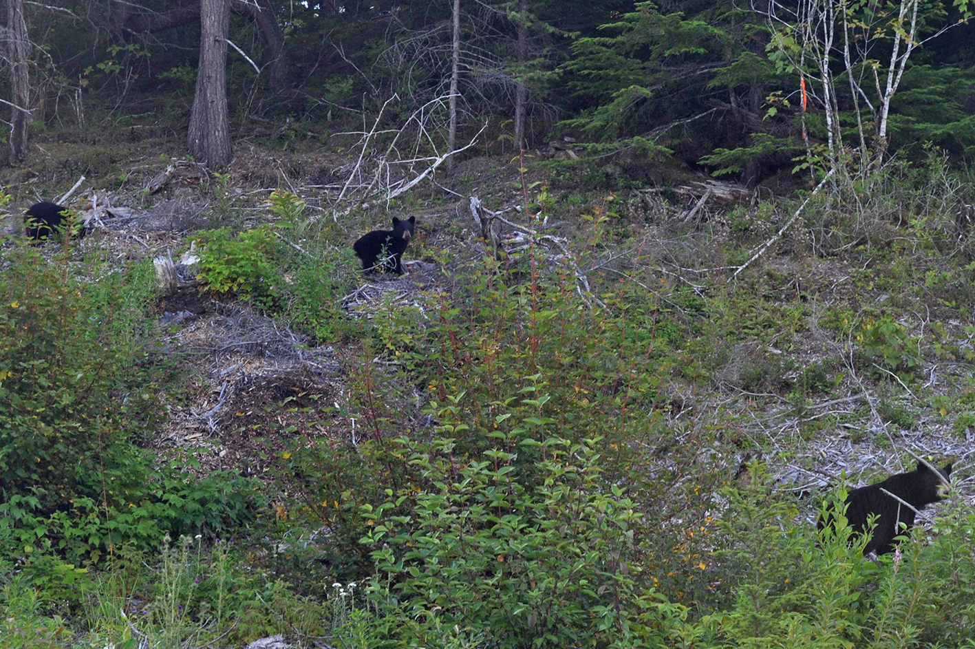
Once you get to Smithers, about 4 hrs west of Prince George, it feels like you are back in wild BC. Bears abound along the roads (we saw a total of 30 black bears along roads on the trip up and back),
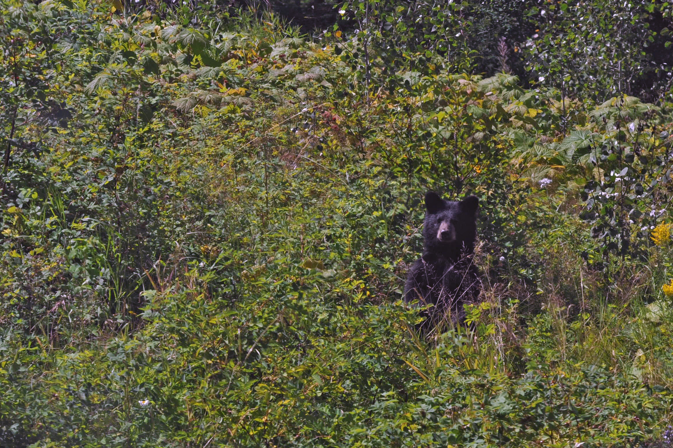
Roadside black bear foraging for veggie snacks
Mother black bear and cubs foraging in the Nass River valley, BC, 2017.
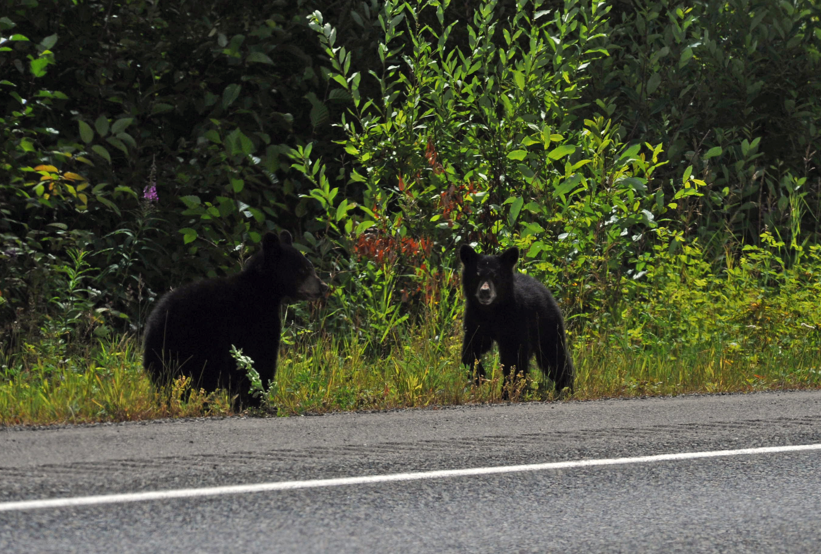
Two black bear cubs feeding along the road on plants along road from Meziadin Junction to Stewart BC, 2017.
along with the occasional moose, fox, coyote, lynx or very rarely a brown/grizzly bear.
The geology is pretty spectacular too. Driving around Terrace BC, you are in the Coast Plutonic Complex, which is the guts of a volcanic arc formed by collision and subduction of the Farallon tectonic plate into and underneath the North America plate during much of the Cenozoic Era (last 65 million years of Earth’s history). Magma intruded into the crust is evident everywhere, and spectacular displays of magma-filled cracks called ‘dykes’ or ‘dikes’ are visible along many roads.
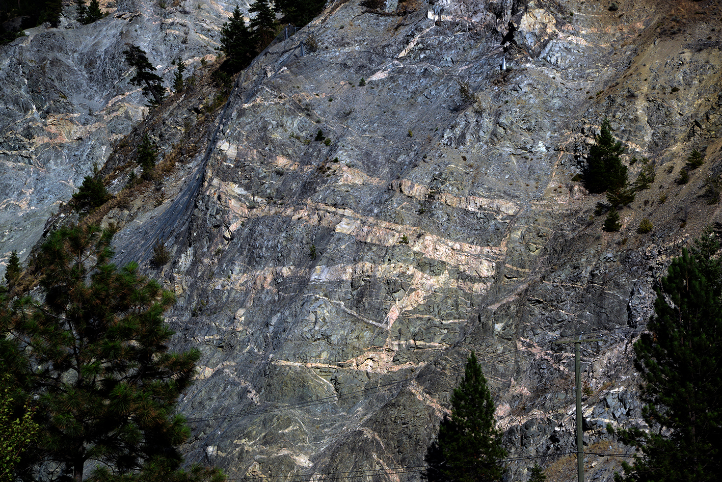
Felsic dyke complex intruded into metamorphic rocks in the Coast Plutonic Complex outside of Terrace BC, 2017.
One of the most perplexing sites is the shrinkage of ice that is visible along roads, in particular the side road from Hwy 37 to Stewart BC (Hwy 37A). This road is one you should not miss! It is one of the most spectacular drives in North America, with astounding waterfalls free falling down the vertical walls of the valley, and close-up views of glaciers, like Bear Glacier. I’ve seen the Bear maybe 7-8 times in the past 25 years, and it has been shocking to see how fast the ice is retreating up into the hills. Views on trips with Dickinson students from 2003 and this year (2017) give a sense of how much ice has disappeared in the past 14 years. The end of the glacier has lost its last bend, and now its end (terminus) doesn’t even reach the edge of its terminus lake.
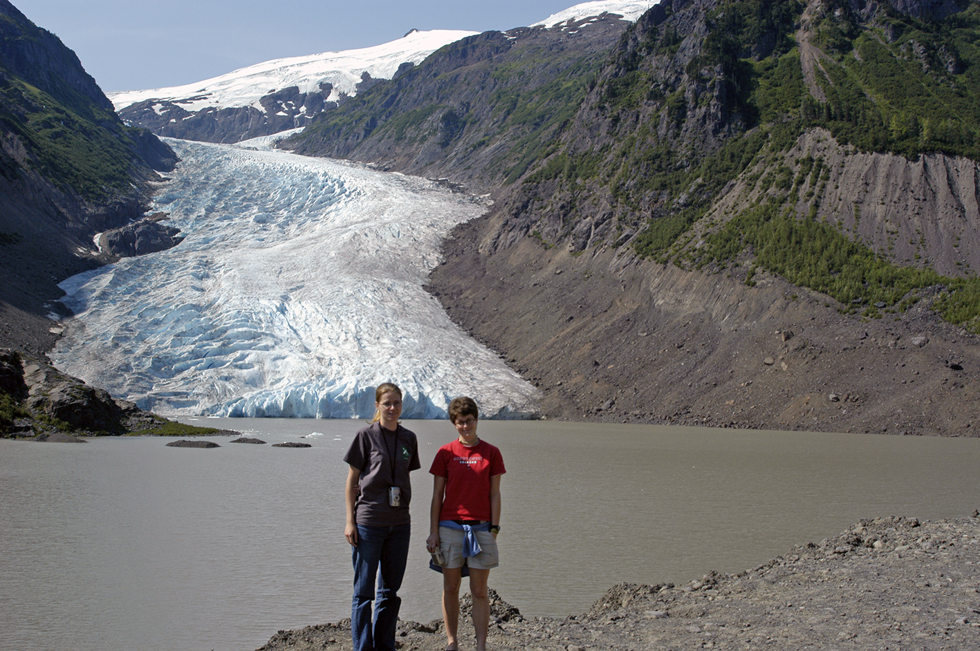
View of Bear Glacier from Hwy from Meziadin to Stewart BC in 2004.
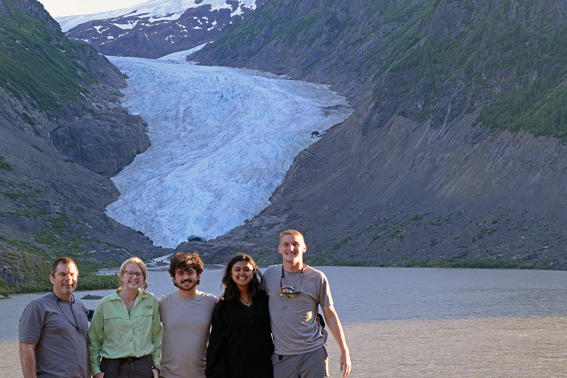
View of the end of Bear Glacier, along the road from Meziadin to Stewart BC, 2017.
We made Stewart our last overnight stay before heading north for the laydown and helicopter pickup site. Always a welcome last spot for dinner, and a quick visit to Hyder Alaska, which is the furthest south point in Alaska to which you can drive…
August 29, 2017 at 1:57 am
Wonderful photos and the basis for a photo and text book entitled something like: Studying Volcanoes and Glaciers through Time.