Background
- History of Cartography (GIS Lounge)
- History of GIS (GIS Lounge)
- Why does mapping matter?
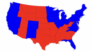
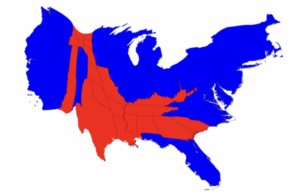
Two view of the 2008 US presidential election results, one option (left) showing simple state-by-state results while the other option (right) offering a population-adjusted cartogram of state results, reflecting the popular majorities in those states who actually voted “blue” for the Democratic candidate (Barack Obama) or red for the Republican candidate (John McCain). For more details, visit this site from Mark Newman at University of Michigan
Selected GIS Maps created by House Divided Project
The GIS map below created by Cooper H. Wingert helps visualize records from the Philadelphia Vigilance Committee and maintained by William Still documenting 995 freedom seekers during the 1850s. The radial lines illustrate the origins of the freedom seekers and their convergence at the Anti-Slavery Office at 31 N. Fifth Street in Philadelphia. Data compiled by William C. Kashatus and James A. McGowan. Originally published in William Still: The Underground Railroad and the Angel at Philadelphia (Notre Dame University Press, 2021), pp. 221-280.


