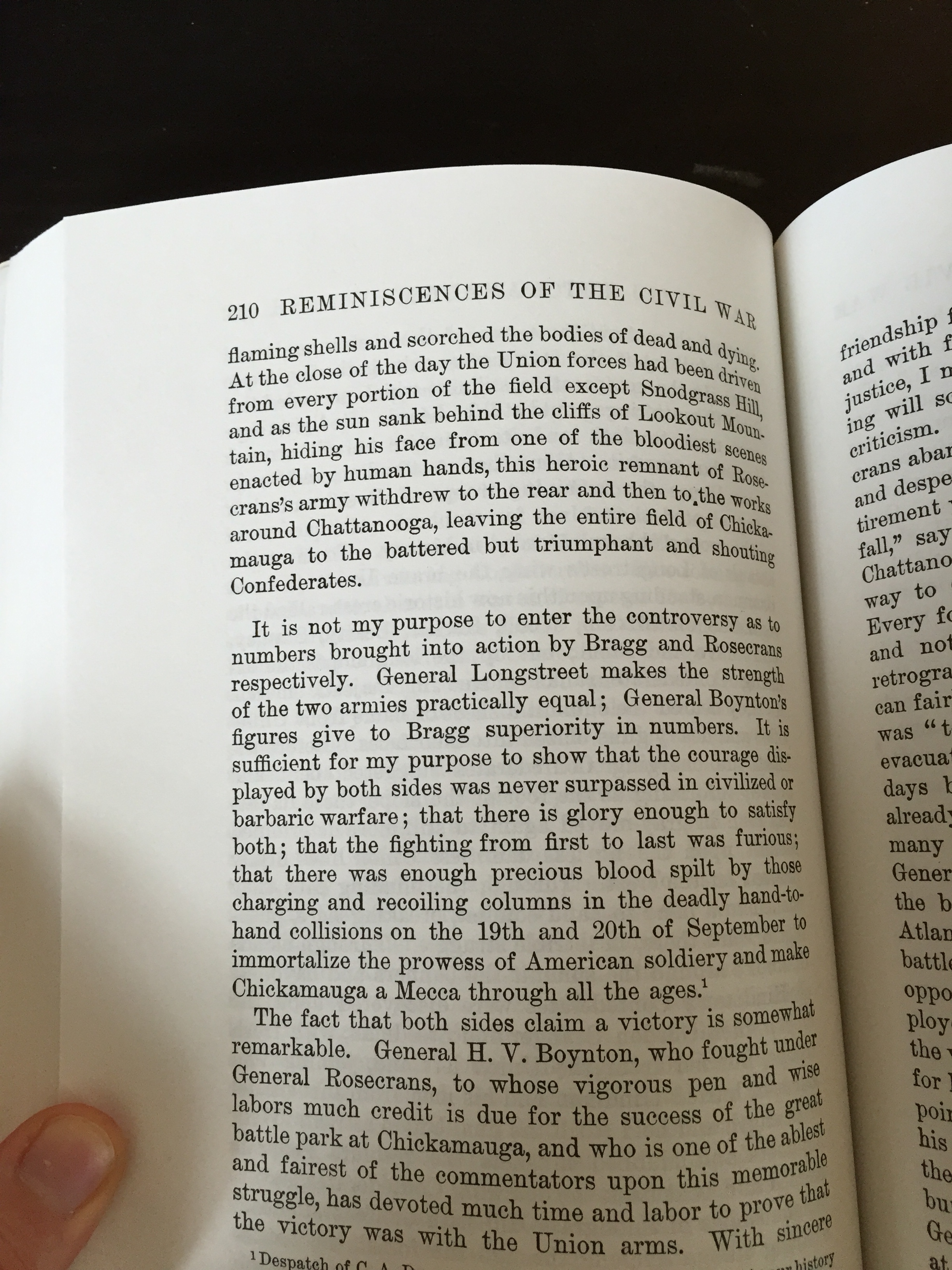
Few battles of the American Civil War provide a better illustration of the importance of topography and geography in a military campaign than the Chattanooga Campaign. The topography of the area surrounding Chattanooga, and the Confederate occupation of the high ground on Lookout Mountain and Missionary Ridge allowed the Confederate forces to hold General Rosecran’s Army of the Cumberland hostage, strangling their ability to resupply. From their position on the high ground, the Confederates could effectively cut off most of the supply roots available to the Union Army, allowing them to slowly starve Rosecran’s forces.[1] However, the benefit offered by the high ground had its weaknesses. The terrain prevented the confederates on the ridge from having a clear line of sight, and dips in elevation along the slope provided ample opportunities for Union troops to seek cover from Confederate cannon and musket fire.
The Chattanooga area also provided significant strategic advantages for the Union forces pushing into the South. While Major General Grant subscribed to Lincoln’s strategic preference for fighting to defeat armies rather than capturing cities, he understood that some geographic locations provided particular strategic advantage to the Union war effort. Chattanooga was the hub of four railroad lines: The Nashville and Chattanooga, Memphis and Charleston, Western Atlantic, and the Chattanooga and Cleveland Railroads.[2] Chattanooga was the “Gateway to the Lower South” and was strategically critical to a Union push into the Deep South.[3] The permanent capture of Chattanooga, secured by the Union victory after Missionary Ridge, set the stage for Sherman’s Atlanta Campaign the following spring. Chattanooga served as a base of operations and a center of the Union supply chain for Sherman’s campaigns through the end of the war.
This map seeks to provide a narrative of the Chattanooga Campaign and of the Battle of Missionary Ridge in particular for a general audience. The map follows the significant events in the campaign, beginning with the battle of Chickamauga, a noteworthy confederate victory. Confederate General Braxton Bragg was able to chase the Union Army into Chattanooga and besieged the town.[4] In order to better understand the physical features of the battlefield, the map is topographical, showing changes in elevation and other physical features such as waterways. Note that the confederate forces were concentrated almost entirely in areas of higher elevation. These strategic decision may have given the Confederates a better vantage point, but it also made maneuvering off of the ridges more difficult. In a letter from an officer in a South Carolina volunteer regiment reporting casualties from the Battle of Missionary Ridge, he notes that “the peculiar positions occupied by a large portion of our Army on the high hills surrounding that place… caused our loss in prisoners to be particularly high.”[5] The map also highlight troop movements, with lines (blue for the Union and Red for the CSA) representing the travel of military units or generals.
The gains from the Union victory in the Chattanooga campaign went beyond simple military success. The resurgence of hope in the South spurred by Confederate victory at Chickamauga was dealt a considerable blow.[8] As Southern morale eroded, the north rejoiced. In addition to pointing out the relationship between topography and strategy, the map provides insight into a shift in Union strategy for the final phase of the war. Victory in the Chattanooga campaign helped propel Grant to command of all Union Armies in March 1864.[6] Grant had built his reputation as a fighting general with his victories at Forts Henry and Donelson and at Vicksburg. Unlike most of Lincoln’s most high ranking generals in command, Grant, and other distinguished Western theater generals like Sherman and Sheridan, were willing to take risks and enact Lincoln’s strategy. Grant”s Overland Campaign proved his willingness to try to capture armies rather than cities, seeking the endgame that previous commanders like McClellan and Meade had been slow to pursue. The war intensified in 1864, as Sherman made his way toward Atlanta and later on to Savannah in his famous march to the sea.[7] While 1964 saw significant human costs, the strategic gains of the 1864 campaigns brought the war toward its close. Missionary Ridge opened up new strategic possibilities to the Union by making Sherman’s expedition through the Deep South feasible.
Primary Sources
“CHARGING MISSIONARY RIDGE.” The Washington Post (1877-1922), Oct 06, 1902.
“FEDERALS, NOVEMBER 25, 1863 STORMING MISSIONARY RIDGE, WON A VICTORY WITHOUT ORDERS.” The Washington Post (1877-1922), Nov 29, 1914.
“GEN. GRANT’S OFFICIAL REPORT OF THE BATTLES OF CHATTANOOGA, LOOKOUT MOUNTAIN AND MISSIONARY RIDGE.” The Charleston Mercury (1840-1865), May 11, 1864.
Gordon, John Brown. Reminiscences of the Civil War. n.p.: Baton Rouge : Louisiana State University Press, 1993., 205, 209–210.
“THE BATTLE OF MISSIONARY RIDGE.” New York Times (1857-1922), Dec 03, 1863.
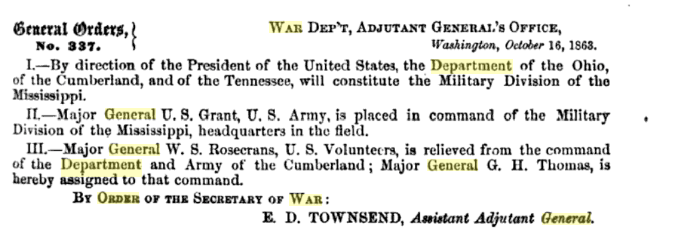
Thomas O’Brien and Oliver Diefendorf, General Order 337, October 16, 1863. General Orders of the War Department, Volume II., (New York: Derby and Miller: 1864), 557.
Jenkins, Micah. Report No. 73 January 13th 1863. The War of the Rebellion (OR) eries 1, Vol. XLIII, (Part 1), p. 0523 [Ohio]
Footnotes
[1] “GEN. GRANT’S OFFICIAL REPORT OF THE BATTLES OF CHATTANOOGA, LOOKOUT MOUNTAIN AND MISSIONARY RIDGE.” The Charleston Mercury (1840-1865), May 11, 1864.
[2] Edwin C. Bearss, Fields of Honor (Washington, D.C.: National Geographic Society, 2006) 251.
[3] Louis P. Masur, The Civil War: A Concise History (New York : Oxford University Press, 2011.) 60.
[4] Weymouth T. Jordan., and John D. Chapla, “‘O what A turbill affair’: Alexander W. Reynolds and His North Carolina-Virginia Brigade at Missionary Ridge, Tennessee, November 25, 1863,” The North Carolina Historical Review, (2000): 320.
[5] J.F. Pressley, “SOUTH CAROLINA CASUALTIES AT MISSIONARY RIDGE.” The Charleston Mercury (1840-1865), Dec 08, 1863.
[6] Louis P. Masur, The Civil War: A Concise History (New York : Oxford University Press, 2011.) 64.
[7] Louis P. Masur, The Civil War: A Concise History (New York : Oxford University Press, 2011.) 74.
[8] Louis P. Masur, The Civil War: A Concise History (New York : Oxford University Press, 2011.) 60.