NPS UGRR Handbook
- Eric Foner, UGRR in Middle Atlantic Region
- Stanley Harrold, Escaping in and around Washington DC
- Deanda Johnson, Escaping on the Northwestern Frontier
Image Gallery

Henry “Box” Brown (1849), colorized by Forbes (House Divided Project)
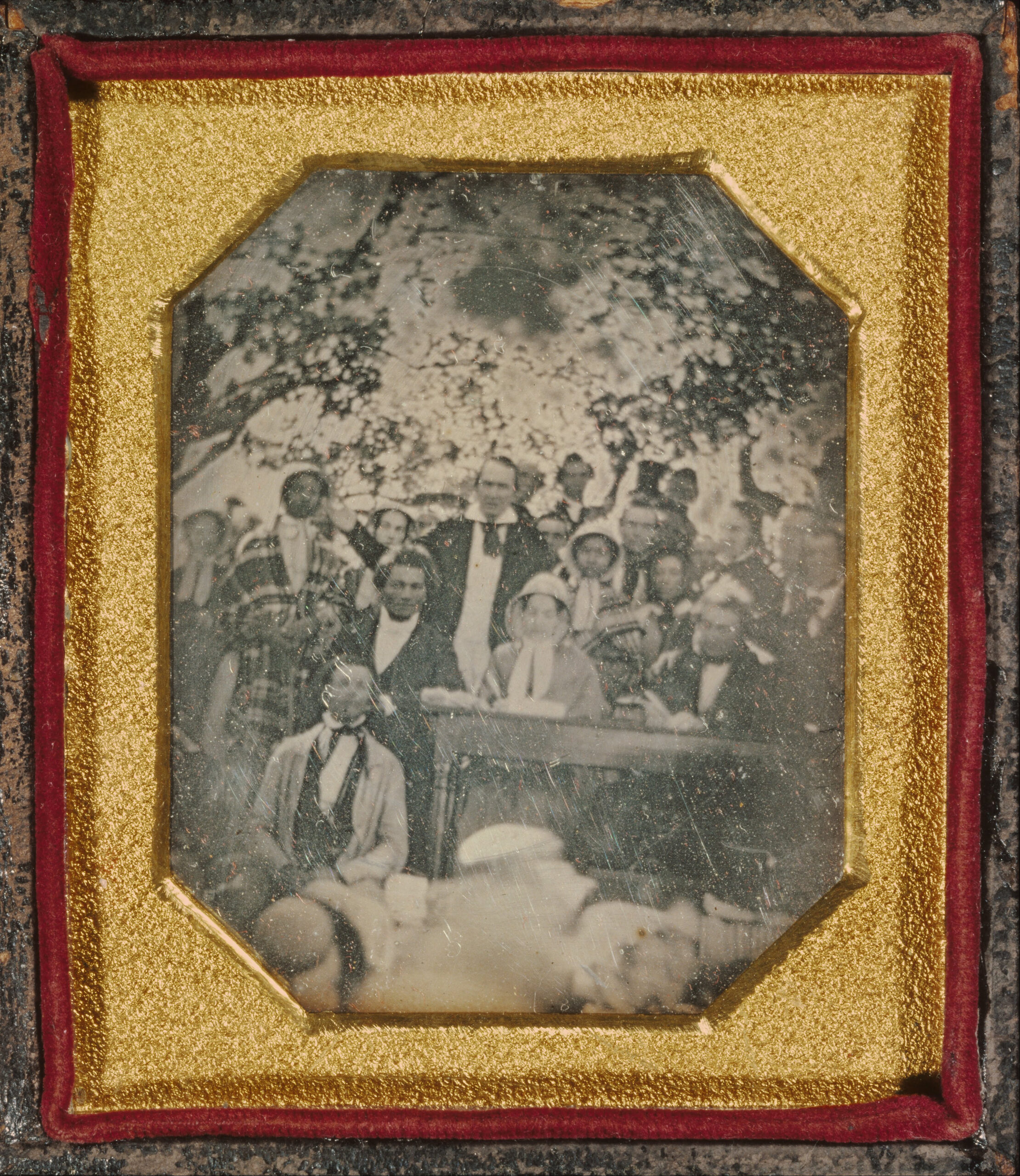
In August 1850, abolitionists met at Cazenovia, New York to protest the proposed Fugitive Slave bill. Participants included Frederick Douglass (seated), Gerrit Smith (standing behind the table), and freedom seekers Mary and Emily Edmonson (standing beside Douglass, both wearing plaid).
Stampede Maps
The Network to Freedom and the House Divided Project have partnered on a major research initiative about Slave Stampedes on the Southern Borderlands, documenting attempted large group escapes from slavery during the period 1847 to 1865. Here are some selected maps from that effort.
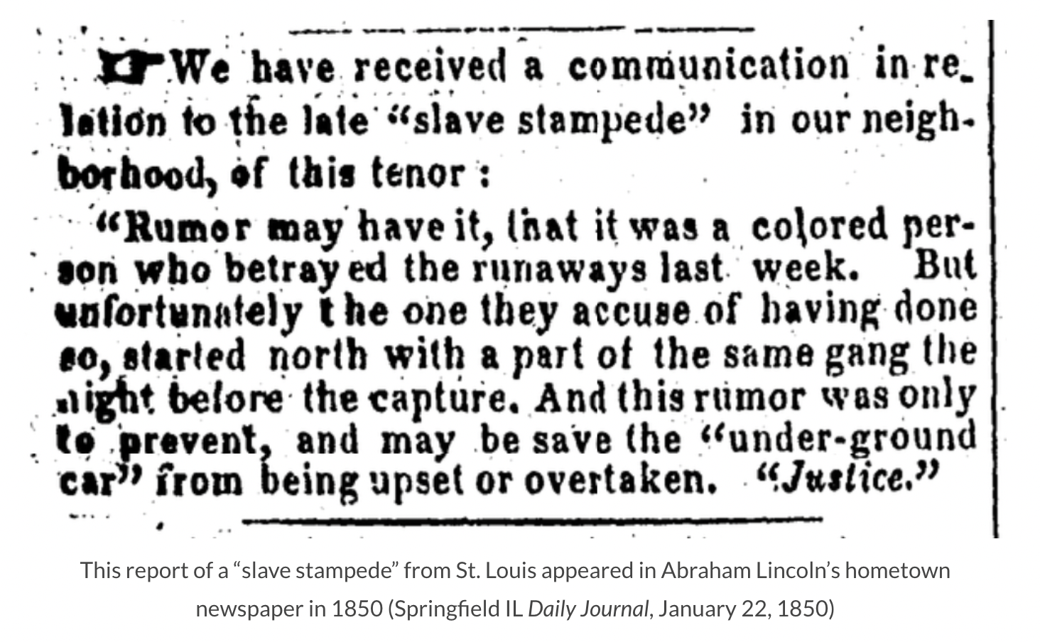
Slave Stampedes, 1847 – 1865
The GIS map below details nearly 200 attempted large group escapes or slave stampedes between 1847 and 1865, as reported in US newspapers. Each dot represents a separate reported stampedes with dots sized according to estimated numbers, from a few freedom seekers to more than fifty. Dark blue dots represent a freedom outcome; light blue equals uncertain (though presumed free); purple equals mixed outcomes, and red dots equal stampedes that ended in death or capture. The dots are clickable for viewing additional data. Created by Cooper H. Wingert.
The custom-made Google map below visualizes newspaper coverage of slave stampedes from 1856 to 1860 with direct links inside the place marks to the articles. Created by staff and students from the House Divided Project.
Video stories