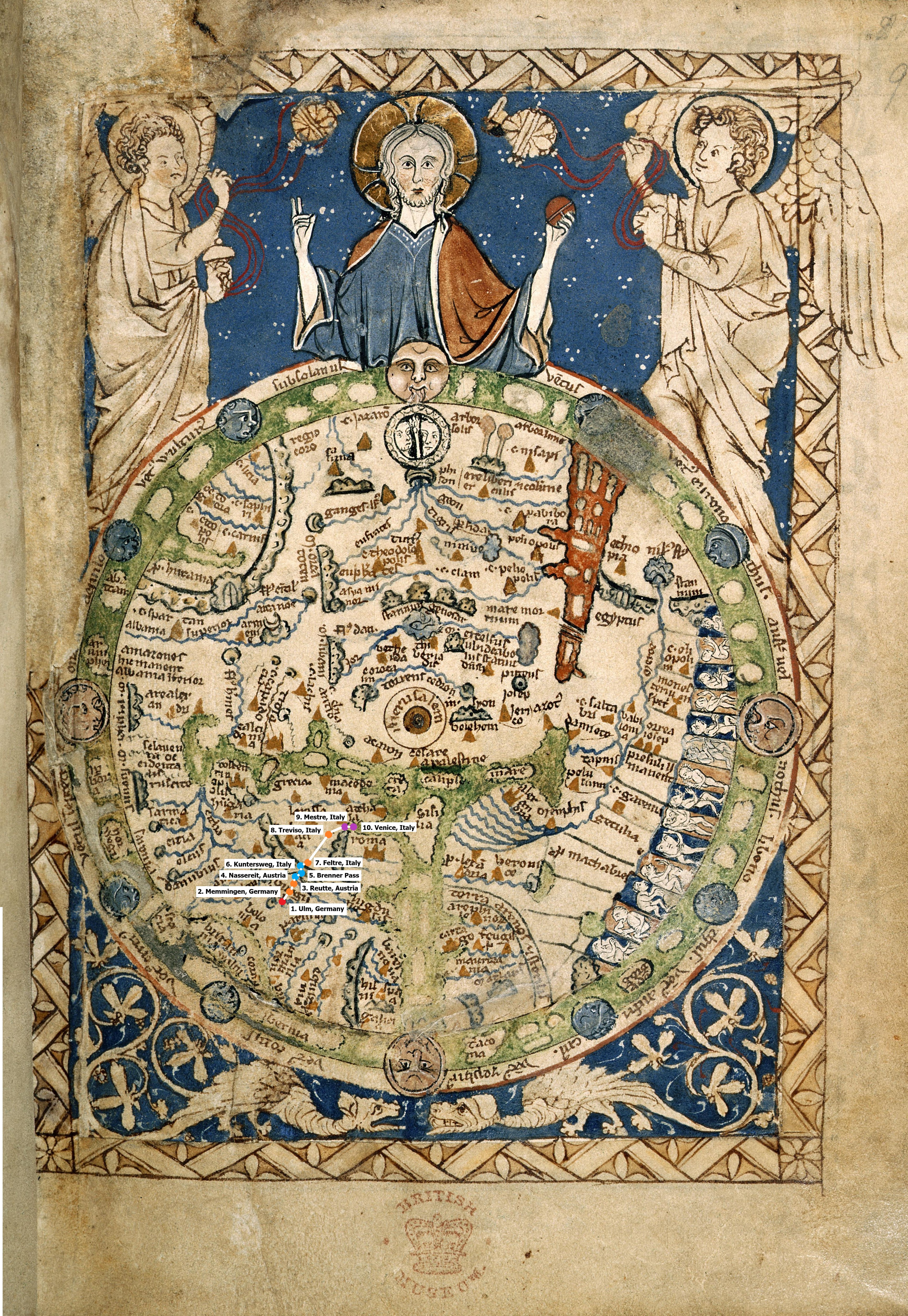
The hardest part about mapping the section of Fabri’s journey I chose on a medieval map is that his journey, in comparison to the Psalter world map as a whole, only occupies a very small geographic area. Within that limited space, the geographical details included on the Psalter world map only vaguely match up with the descriptions Fabri gives in his account, which are fairly accurate to the modern map and the actual geographies he traveled through.
It was easiest to plot Mestre, Italy and Venice, Italy on the medieval map because Italy is still drawn as a peninsula, albeit very circular and consisting mostly just of Rome. Venice is along the northeast coast of Italy, and Mestre a bit inland from Venice, so their relative locations on the medieval map were the most straightforward.
Plotting the locations in the Alps Mountains was complicated because it’s not made clear which mountain range is which on the Psalter world map, so I just had to make an educated guess based on the location of Greece and the assumption that the Dinaric Alps were included on the map. Within the range that I assumed to be the Alps, there wasn’t much space to plot the multiple stops Fabri made while journeying through them, which is both a function of the scale of the map and of the lower importance placed on that part of the world. Generally, plotting most of the stops I chose from Fabri’s journey was difficult because the Psalter world map’s representation of Europe is condensed. The further north the location, such as those in Germany, the harder it was to plot the town because Europe is not given as much space, as the focus is Jerusalem and the Holy Lands as the center of the world.
The orientation of the Psalter world map complicated my plotting of Fabri’s travels on it because most modern maps are oriented with North on the top, while East is up on the Psalter world map. Given theological views of paradise being in the East, this makes sense, as the Psalter world map is religiously based. The orientation of the Psalter map points to the great importance of religion at the time of its creation, whereas the modern map’s orientation reflects the perceived greater importance of northern hemisphere nations as leaders in politics and economics and the history of countries in the northern hemisphere as colonizers of those in the southern hemisphere.
