Tag: training

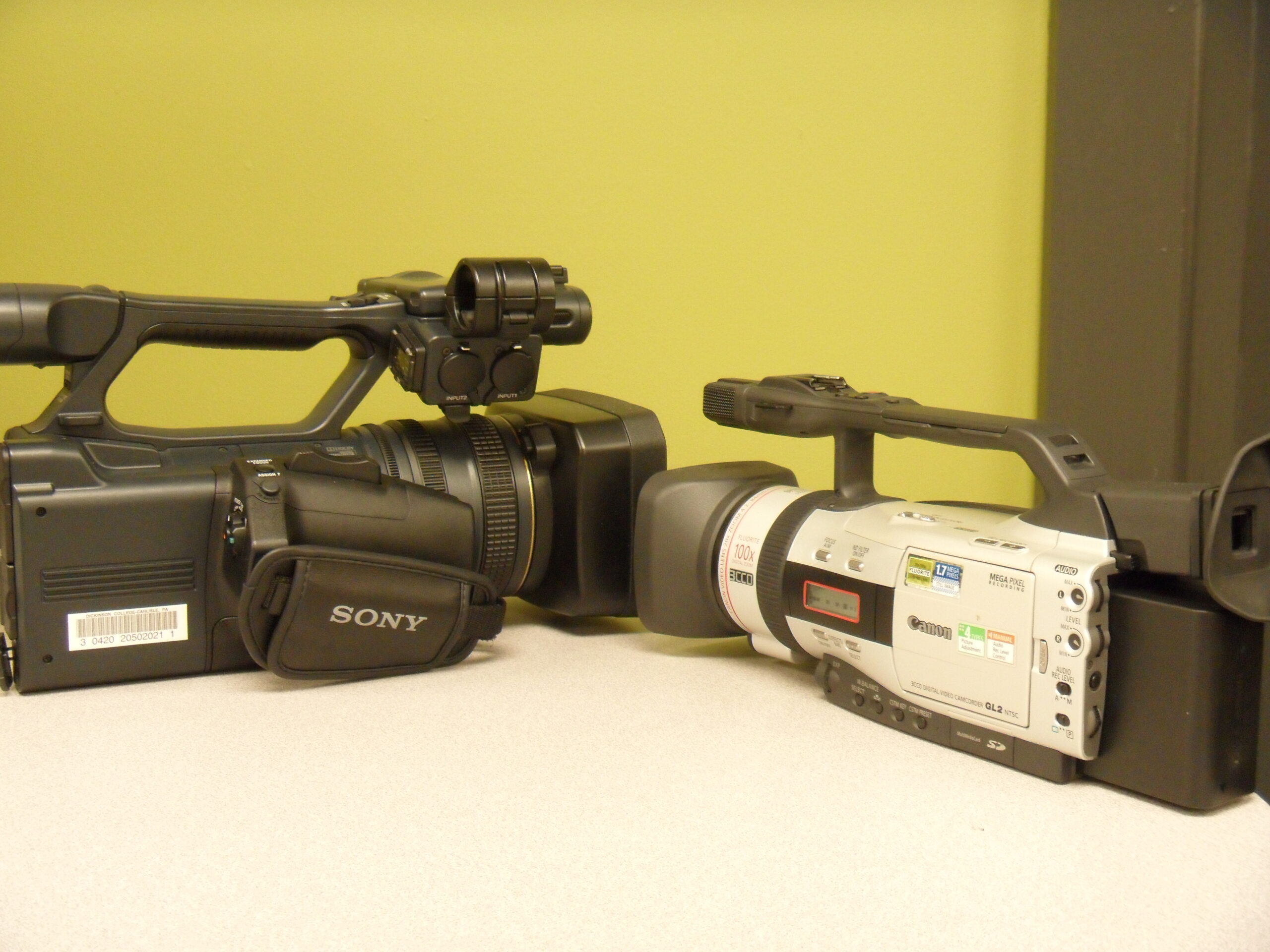
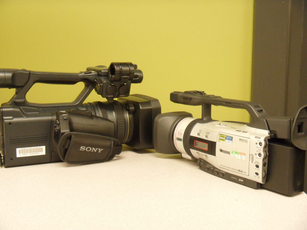
Workshop: 3CCD and 3MOS Training

If you would like to learn how to operate our pro-sumer style Digital Video Camcorder, there will be a Workshop given on Friday the 17th in the Media Center Studio (Bosler 008).

—Update times are set there will be two sessions one from 3:00 to 4:30 and another from 5:00 to 6:30. People who responded to the survey and film students will get first priority but more are welcome for both times.


Historical Simulations Using Civilization IV

Description

Civilization IV is a PC game that allows the player to control a civilization from 4000 BC until the modern era.   The player needs to make decisions regarding resource management, diplomacy, technology research and civics in order to successfully guide the civilization into the modern era.  The game can also be modified to represent the world as closely as possible at a given point in history.

Audience

Faculty and students in political science, history, sociology and religion.

Type

Instructor Led-Hands On

Time

50-100 Minutes – In Class Time

Outcomes

  • Recognize the importance of various resources, technological advances and geographic location in historical events.
  • Understand and critique the advantages each of the civics presented in the game for the growth of the civilization.
  • Recognize and critique the argument presented by the game for the cause of conflicts throughout history focusing on resource scarcity, conflicting religions or civics, and population growth.
  • Conduct research on population trends, technology advances, role of religion, and the allocation of resources at various points in history.  (Advanced, for student mod creation projects)

Want to know more?  Contact  bryantt AT dickinson.edu to set up a consultation.

Examples

Professor Michael Fratantuono – “Globlaization, Sustainability, Security”

In this first year seminar, Professor Fratantuono had his students compare what they’d learned from “Guns, Germs, and Steel” and “Hot Flat and Crowded”  with their experience playing the game Civ IV.

Professor Ed Webb – “Empire”

In this International Studies course, Professor Webb instructed his students to play a historical mod of Civ IV that represents the western world in 1492.  Students took on the role of Spain and their first encounter with the Aztecs.  Students then compared their own actions and situation with history and used the ideas from “The Conquest of America: The Question of the Other” to discuss possible reasons for discrepancies.

http://www.escapistmagazine.com/articles/view/issues/issue_203/6097-Dont-Knock-the-Aztecs

Smart Classrooms & Student Response Systems

Description

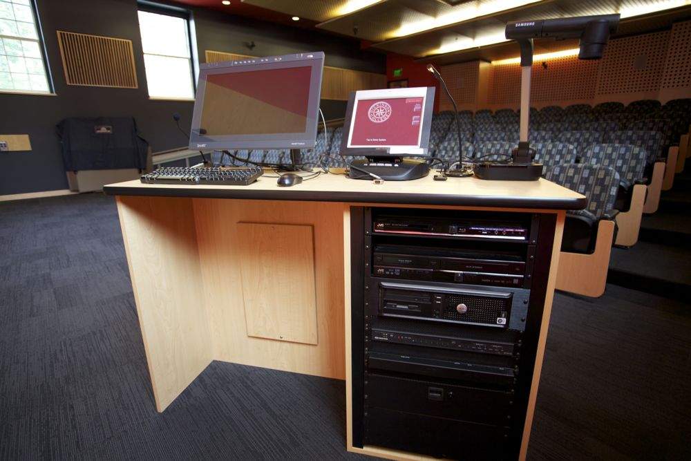
Many classrooms on campus are outfitted with an array of technologies available for faculty and student use.  From computers and projectors to datavisualizers and smart boards/sympodiums, we are ready to help you understand how to use the technologies available to you.

Audience

Faculty & Students

Type

Instructor Led-Hands on

Time

30 Minutes-Outside of Class Time

Outcomes

  • Learn to use media controllers, Smart Board/Sympodium, Projectors & Data visualizers
  • Understand basic troubleshooting techniques

Outline

Student Response Systems

Backchannel tools

Guest or Distance Presentation


Intro To Video – Training Outline

Outline

Dickinson Examples:

  1. Ken Burns Style/Storytelling-Asian Art – Sherri Lullo-Imovie
  2. Ken Burns Style/Mashup – Wal-Mart – Michael Fratantuono
  3. Text/Live Motion Video – Close Reading – Writing Center
  4. Live Motion Video/WhiteBoard – Outline-Draft-Revision – Writing Center
  5. Ken Burns Style/Storytelling/Oral History – Carlisle to Andersonville – House Divided Project
  6. Green Screen/Silent – Samurai Movie – Prof Alex Bates
  7. Live Motion Video/Stop Motion – Sonnet – Prof Mark Aldrich
  8. Live Motion /Explanation – E G G C E P T I O N – Prof Christine O’Neill

Different Style Options

  1. Interview
  2. Screen Capture
  3. Explaining Style
  4. Behind the Desk/News Style
  5. Simple Animation

Assignment Preparation

Student Treatment Plan Form-(copyright Dartmouth College)
Example Video Grading Rubric

Imovie

IMovie Tutorial

  • Video Editing
    • How to record video-ISight Camera
    • How to import video from camera or computer
    • Editing
      • Selecting portions of video
      • Fine editing
      • Adding Distortions/Enhancements to video
        • Speed up/Slow Down
        • Color/Style
    • Understanding Clip Pane
      • Color coded clips (Used in Project, Favorites, Deleted)
    • Transitions
    • Titles
  • Audio
    • Pulling in tracks
    • Recording Narration
    • Layering Audio
  • Adding Images
    • Ken Burns Effect
    • Adding Distortion/Enhancement to images
      • Color
    • Saving
  • Exporting
  • Burning to DVD

Resources

Music-Sound Effects CCMixter-variety of music styles
Moby Gratis – Free music from your favorite Electronica artist (yeah, that guy)
Museopen-free classical works
Free Sound Project-Authentic Sound Effects

Images
Flickr Commons – Museum Collections
Creative Commons

Video
Archive.org
Free Public Domain Movies
Open FLV.com
Wikimedia Commons
National Archives
Stage 6
Public Domain Torrents
EMOL
Public Domain Movie Database

Fair Use Checklist-Help deciding if you can use a copyrighted work in your project


Podcast Training Outline

Outline

Audio Examples

  1. Creative Style – Role Playing
    Tesman First Year Seminar Tesla VS Edison
    Dave Jackson-Quantum Mechanics-FYS-Time Travel
  2. Good Intro-Connects with Audience-Good imagery
    Jeremy Ball- Atlantic Slave Trade – Carolina Low Country
    Dave Richeson – Shoulders of Giants – Square root of 2
  3. Live Recording-No post production
    Panel Style-Helwig Larsen- Why People Believe Weird Things
    Individual-Public Service Announcement-Jim Hoefler-One Green Minute
  4. Interview excerpt
    Dan Schubert- Untold Stories of Disease & Disability – Obesity
  5. Foreign Language
    Poetry- Chris Francese – Latin Poetry Podcast
  6. Blended Layers of Audio
    Ted Merwin-Great Secular Jews in HistorY
    Missy Niblock-Writing Science News-Commercial Space Travel

Image Example

  1. Sherri Lullo-Imovie-Ken Burns Style-Asian Art

Video Examples

  1. Interview
  2. Screen Capture
  3. Explaining Style
  4. Behind the Desk/News Style
  5. Simple Animation

Podcast types

  1. Public Service Announcement
  2. News Story
  3. Oral History
  4. Interview
  5. Poetry/Theatre/Arts

Discussion-Best Practices

  1. Journalism- Inverted Pyramid of information
    Lead with hook
    Draw audience in
    Personalize with audience
  2. Public Speaking
    Practice aloud
    Practice in front of audience
    Evaluate tone
    Emotions come through in voice
  3. Copyright
    Creative Commons
    Fair use in education

Presentation Methods

  1. Audio only
  2. Image/Slide based
  3. Video

Audacity

  1. Recording
  2. Editing
  3. Inserting Audio
    CCmixter – Music
    Freesound – sound effects
  4. Saving
  5. Exporting

Garageband

  1. Enhanced podcast

IMovie

  1. Images
  2. Effects
    Ken Burns
    Filters
  3. Titles
  4. Transitions
  5. Audio
    Narration
    Music/Sound effects
  6. Exporting

Posting Podcast

  1. Itunes RSS feed
  2. Dickinson Blog

Subscribing to podcast

  1. Rss Reader
  2. ITunes

Example Assignment

  1. Richeson: Math
  1. Francese: Latin Poetry

Discussion – with Faculty – Project Consulting

  1. Concerns with project
  2. Adaptability of project to fit scope/class
  3. Assessment

Resources

Music
ccmixter-variety of music styles
Museopen-free classical works

Sound Effects
Freesound.org

Images
Flickr Commons – Museum Collections
Creative Commons

Video
Archive.org

Copyright
Fair Use Checklist-Help deciding if you can use a copyrighted work in your project

Take Aways

Tutorials

  1. Audacity
  2. IMovie
  3. Garageband

GIS Overview

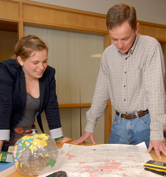
Instructional & Media Services has a full time GIS Specialist on our staff to support GIS projects in all disciplines.  Our specialist, Jim Ciarrocca, is available for consultations on possible projects.  Here are a few examples of past GIS workshops.

Introduction to GIS

GIS (Geographic Information System) is a way of capturing, analyzing, and displaying data in a spatial manner. While Google Earth may be able to perform some of these functions, ESRI, the GIS software supported on campus, allows for the entry and analysis of much larger and sophisticated data sets. Faculty in Geology and Environmental Studies are already using this software for their classes or research.  This workshop will demonstrate how faculty from other departments across the curriculum can use GIS to display information spatially in a manner that is accessible for everyone.

GIS: Making Simple Maps

In this introductory workshop we will explore using geographic information system (GIS) software from ESRI to build a simple map.  We will start with a predefined lesson and data set.  Tasks will include layering the data onto a base map, classifying and symbolizing the information, adding a title and legend, and saving the finished map in a format suitable for publication.

Introduction to Spatial Literacy

Understanding how to think about problems and concepts in a spatial context is a fundamental skill that is not well taught in the American educational system.  Often referred to as “Spatial Literacy”, this type of thinking focuses on understanding the importance of geographic space, and the relationships formed by this space.  Spatial Literacy is not a stand-alone subject, but rather it is a way of thinking that cuts across all fields of studies, and is becoming increasingly important as a necessary skill for liberal arts graduates across all disciplines.  A powerful technology for engaging spatial thinking is called Geographic Information Systems (GIS), which provides sophisticated tools for collecting, managing, analyzing, and visualizing spatial data.

Google Earth allows users to embed and display information on top of a representation of the world created via satellite photos.  In this workshop we’ll go over basic navigation of the Google Earth interface, as well as Google sponsored layers, including historical maps and government data bundled with the latest release of Google Earth.  Finally, we’ll demonstrate how you can enter your own text and images, and then attach them to a location.
© 2024 Dickinson College Media Center


Academic Technology services: GIS | Media Center | Language Exchange

Theme by Anders NorenUp ↑