Prof. Christofilis Maggidis sends along this report on his work documenting the Lower Town at Mycenae. The 3-D scanning and reconstruction work was partly funded by Dickinson Digital Humanities grants over the summers of 2013 and 2014.
The archaeological investigation of the Lower Town of Mycenae (2001-to date) aims to reveal the relationship between the citadel/palace of Mycenae and the surrounding settlement, and to show land development and public works (fortification walls, roads, bridges, dams, irrigation, terracing). The Geometric settlement (houses, workshops, silos, graves) dates to the 9th-8th century BC; these Geometric ruins are the first and only ones discovered so far at Mycenae since Schliemann’s excavations in 1874, and establish the cultural continuity of the site in the transition from the end of the Bronze Age, after the collapse of the Mycenaean world, to the historical period of the Early Iron Age. The underlying Late Mycenaean urban settlement (fortification walls, gates, houses, storerooms, dams, etc) dates to the 13th century BC, This is the first time that the very existence of the Lower Town is archaeologically established.
[youtube_sc url=”https://www.youtube.com/watch?v=vIEE7i8C_nE&feature=youtu.be”]
The Mycenae GIS database built by the Dickinson team includes geology, terrain and topography (based on digitized Hellenic Military Geographical Service topographic maps, geological maps, satellite photos, and Total Station points), geophysical survey (subsurface architectural features detected by remote sensing), architectural remains, archaeological contexts, features, and finds (embedded and catalogued by date, accession number, material number, layer/context number, geodetic coordinates, grid-square and locus, photos and drawings).
The G.I.S. geodatabase further integrates a 3-D digital reconstruction of the Lower Town. . This comprehensive 3-D digital model of the site will constitute an interactive learning tool, but also a pioneer and dynamic digital publication platform with a powerful database, incorporating and illustrating the architectural development of the buildings with all successive construction or modification phases, their finds, and their surroundings.

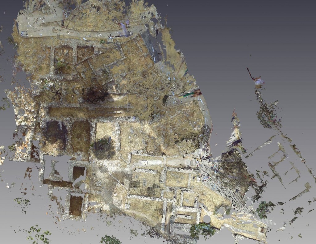
The site scanner shoots millions of georeferenced points from many different angles and locations to compose a highly accurate (5mm) georectified ground plan
This past summer, all excavated architectural structures of the palatial workshops at Mycenae, including buildings, walls, floors, deposits, gates, and roads were scanned with a 3-D Terrestrial Laser Scanner, which was leased for a period of three weeks from the Demokritos University of Thrace (Prof. Nikolaos Lianos). The site scanner shoots millions of georeferenced points from many different angles and locations to compose a highly accurate (5mm) georectified ground plan, thousands of cross-sections of orthogonal axial tomography (like a Cat-scan), and a ‘walk-through’ rotating 3-D model of the site, which forms the basis for the 3-D digital reconstruction of the workshops. Next year, the plan is to scan and photograph from the air the whole valley of the Lower Town and the cyclopean walls of the citadel in the backdrop using a videocamera-equipped drone in order to digitally recreate the precise terrain and background for the 3-D town/citadel model which will then form the basis for the georeferenced 3-D digital model of the ancient landscape.
For more information about the Mycenae Lower Town Excavations, see here and here.